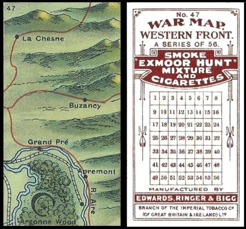
This is series one but the map still shows fighting along the Meuse and into the Argonne Forest, shown by the big letter C, which was also the last stand, because from September the 26th to November the 11th, 1918 the Battle of the Argonne was fought in that small wooded area which appears on this map.
This was the third and last phase of the Battle. By the start of November American forces had come through and cleared the Argonne Forest of opposing forces. This brought them to the French at the River Aisne, which they were unable to cross until the German defences at Buzancy were brought down. After that had been accomplished, they fought the Battle of Le Chesne (which seems to be mis-spelled as La Chesne on the card) and captured the hilly regions also shown on the card.
And then they heard the news of the Armistice on November 11th.
It seems stirring stuff there, but it was long hard fighting, many deaths, and injuries, and almost every one of the soldiers, in some way, was changed, for ever.....
So here we have the first series of this set, and, thrillingly, its in colour. It is described in our World Tobacco Issues Indexes as :
WAR MAP, WESTERN FRONT. Sm. Nd. (56).
Now in here it is the first set of War Maps listed in the book, maybe because it was the earliest set to be issued, or maybe because the longer title of the second series flummoxed the cataloguers. However it was actually out of alphabetical order, so in our updated version of the World Tobacco Issues Index the two switch place.
